Small Town Planning DWG with 420m by 290m Urban Layout Design
Description
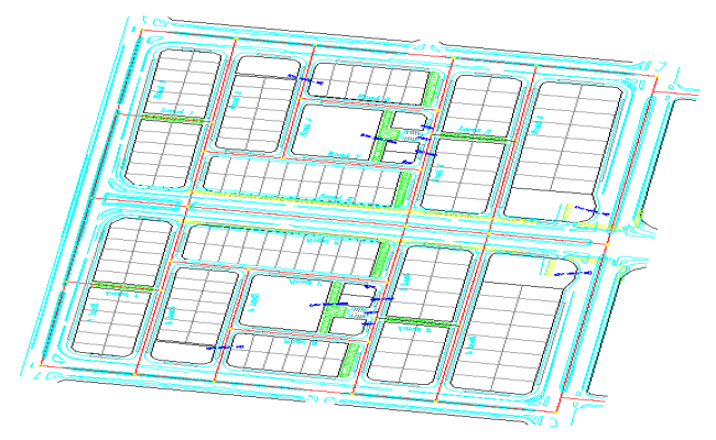
This Small Town Planning AutoCAD DWG file features a complete 420m by 290m urban layout including road networks, residential plot divisions, service corridors, footpath markings, and landscaped green strips. The drawing displays a well-organized street hierarchy with primary, secondary, and tertiary access routes, allowing smooth traffic movement across the grid. Each block contains logically arranged plots, pedestrian links, parking lanes, and public open spaces. Utility routes such as drainage lines, water connections, and distribution channels are clearly shown using color-coded layers for convenient identification. The central zone includes designated public amenities, surrounded by compact residential clusters and landscaped zones.
Ideal for architects, civil engineers, urban planners, and infrastructure designers, this DWG supports smart town planning and community-focused development. The clean drafting style and proportional block distribution allow accurate evaluation of mobility patterns, land-use efficiency, pedestrian circulation, and open-space ratios. With clear markings, structured boundaries, and detailed service routes, this file serves as a practical reference for planning sustainable, functional, and modern small-town environments.
File Type:
3d max
File Size:
904 KB
Category::
Urban Design
Sub Category::
Town Design And Planning
type:
Free

Uploaded by:
Jafania
Waxy